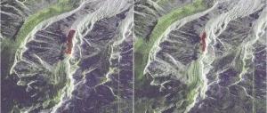
Geological disasters like landslides, earthquakes, and floods threaten lives and property worldwide. Early detection can save many. SAR radar is a powerful tool for this work. Let’s explore how it helps in disaster monitoring.
What Is SAR?
SAR stands for Synthetic Aperture Radar. It is a remote sensing technology. Unlike optical sensors, it works day and night. Bad weather like rain or clouds does not stop it.
SAR sends microwave signals to the Earth’s surface. These signals bounce back. The radar catches them. By analyzing the returned signals, we get detailed images of the ground. This process works from satellites or aircraft.
Why SAR Is Good for Disaster Monitoring
Disaster monitoring needs timely and accurate data. SAR meets these needs well.
First, it works in all conditions. Storms or darkness do not block its view. This is crucial during active disasters when other tools fail.
Second, it captures changes over time. By comparing images taken at different times, we can spot small movements. These movements often signal coming disasters like landslides.
Third, it covers large areas. This is better than checking small spots on the ground. It helps monitor wide regions at risk.
High-Resolution SAR: A Better Tool
High-resolution SAR takes SAR’s strengths further. It provides clearer, more detailed images.
With high resolution, we can see small changes. For example, a 1-meter shift in the ground becomes visible. This is key for early warnings. Small shifts may lead to big landslides later.
High-resolution images also show details of disaster areas. After an earthquake, they can map cracks in the ground or damaged buildings. This helps rescue teams focus their efforts.
How SAR Detects Different Geological Disasters
Landslides
Landslides are common and dangerous. SAR tracks them before they happen.
SAR images over time show if soil or rock is moving. Even slow movements of a few centimeters per year can be seen. Experts study these changes to predict when a landslide might occur.
After a landslide, SAR images show the affected area. This helps assess damage and plan rescue work.
Earthquakes
Earthquakes cause the ground to shift. SAR can measure these shifts accurately.
By comparing images before and after an earthquake, we can map the area affected. This helps experts understand the quake’s strength and impact.
SAR data also helps in planning for future earthquakes. It shows which areas are more likely to shift, guiding building safety rules.
Floods
Floods spread quickly. SAR can track their movement in real time.
Microwaves from SAR can pass through clouds and rain. This means it can monitor floods even during bad weather.
Images from SAR show how far floodwaters have spread. This information helps authorities send help to the right places and warn people in danger.
How to Use SAR Data
Using SAR data for disaster monitoring involves a few steps:
- Collect Images: Satellites or aircraft take SAR images of the area of interest. These can be taken regularly to track changes.
- Process Data: Special software processes the images. It turns the raw data into clear maps showing ground movements or flood areas.
- Analyze Results: Experts look at the maps to spot signs of possible disasters. For example, they check for areas where the ground is moving slowly, which might mean a landslide is coming.
- Take Action: Based on the analysis, authorities can issue warnings, send rescue teams, or plan evacuations.
Advantages Over Other Methods
SAR has several advantages over other ways of monitoring disasters:
- Works in All Conditions: Unlike optical cameras, SAR is not affected by clouds, rain, or darkness. It can monitor disasters 24/7.
- Catches Small Changes: High-resolution SAR can detect movements as small as a few millimeters. This early detection saves lives.
- Covers Large Areas: SAR can image thousands of square kilometers in one go. This is more efficient than checking small areas on foot or by plane.
Future of SAR in Disaster Monitoring
SAR technology is improving. New satellites with higher resolution are being launched. They can take images more often, providing up-to-date data.
In the future, SAR might work with other tools like drones or sensors on the ground. This combination will make disaster monitoring even more accurate and fast.
Experts also hope to make SAR data easier to use. Simple apps could let local authorities check SAR maps and act quickly during a disaster.
Conclusion
SAR radar is a game-changer for geological disaster monitoring. It works in all conditions, catches small changes, and covers large areas. High-resolution SAR makes it even more effective.
By using SAR, we can detect disasters earlier, respond faster, and save more lives. As technology improves, its role in keeping people safe will only grow. For anyone working in disaster management, SAR is an essential tool.