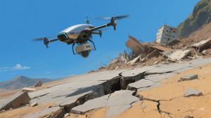
Earthquakes often cause severe surface deformations, such as landslides, ground sinking, and fault ruptures. In post-earthquake disaster monitoring, SAR (Synthetic Aperture Radar) plays a key role. Its unique technical features and practical uses make it essential for assessing disasters and guiding rescue efforts.
I. The Core Role of SAR Radar in Post-earthquake Monitoring
- Real-time and Wide-area Monitoring Abilities
After an earthquake, disaster areas face complex challenges. Damaged roads and bad weather make traditional ground surveys unable to cover large areas quickly. SAR radar, which are mounted on satellites or aircraft, can monitor the area day and night, regardless of clouds, rain, or darkness. For example, after a major quake, SAR radar can scan the entire disaster zone fast. It detects surface deformations promptly, giving rescue teams real-time info about the disaster’s scope and severity. This helps them make quick and accurate rescue plans.
- Key Function in Disaster Early Warning and Secondary Disaster Prevention
Post-earthquake surface deformations can trigger secondary disasters like landslides. By continuously watching mountain slopes and unstable areas, SAR radar spots potential disaster signs early. When it notices abnormal ground movements, such as faster sinking or slope shifts, it warns relevant departments. These departments can then evacuate residents or reinforce risky areas in advance, greatly reducing losses from secondary disasters.
II. Technical Practice of SAR Radar in Post-earthquake Monitoring
- High-precision Deformation Monitoring with InSAR Technology
In practice, SAR radar uses InSAR (Interferometric Synthetic Aperture Radar) to monitor deformations precisely. This technology compares SAR images of the same area taken at different times to get deformation data. When the radar sends electromagnetic waves to the ground, the reflected signals carry surface info. Analyzing the phase difference between images lets us calculate subtle ground changes, with accuracy down to millimeters. For instance, in monitoring post-earthquake fault activities, InSAR can measure fault zone displacements accurately, helping geologists understand earthquake movements and assess aftershock risks.
- Important Data Processing Steps
Processing SAR radar data is a vital step. After getting SAR images, we use special software for tasks like image registration, interference phase extraction, and deformation inversion. These need precise algorithms and computing power. Recently, AI technology has improved data processing efficiency. Machine learning algorithms can automatically identify deformation features in images, cutting manual work and speeding up disaster assessment.
- Combining with Other Monitoring Technologies
SAR radar can work with other monitoring tools to form a comprehensive system. For example, integrating with GPS networks provides more complete deformation data—GPS measures point displacements, while SAR gets area-wide info. Combining them improves monitoring accuracy and scope. Working with UAV surveys also helps, as UAVs can investigate key areas in detail, providing ground truth for SAR results.
Many real-world cases show SAR radar’s importance. After the 2011 Tohoku earthquake in Japan, it helped monitor surface deformations for reconstruction planning. In China’s 2008 Wenchuan earthquake, it aided in disaster assessment and secondary disaster prevention. As technology advances, SAR radar will play a bigger role in post-earthquake monitoring, better protecting lives and property.