


A Wake-Up Call from the Skies
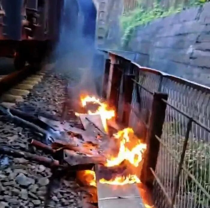
On June 30, 2025, a heavy-lift drone crashed during an unauthorized test flight along the Shawan section of the Chengdu-Kunming Railway, igniting surrounding infrastructure and forcing freight train No. 86920 into an emergency halt. The disruption lasted 4 hours and 13 minutes, causing a direct economic loss of $27,000.
This was not an isolated incident. In just the first half of 2025, China recorded multiple drone-related violations—from interference with civil aviation to intrusions into military zones—highlighting growing risks as the low-altitude economy takes off.
Explosive Market, Exposed Skies
China’s low-altitude economy is booming. According to iiMedia Research:
- The market is expected to grow from $79.036 billion (2025) to over $583.3 billion by 2035.
- In 2024 alone, 1.1 million new drones were registered, with 20,000+ licensed operators now active.
This rapid expansion brings unprecedented opportunities in drone logistics, urban air mobility (UAM), and aerial tourism—but also creates complex low-altitude security challenges. Rogue drone flights increasingly overlap with commercial air routes, rail corridors, and critical infrastructure, exposing regulatory and technical blind spots.
The 3 Hidden Risk Gaps Undermining Low-Altitude Security
1. Regulatory Blind Spots
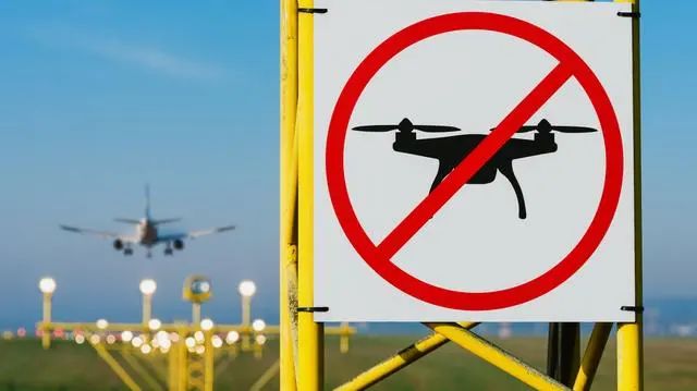
Despite flying within a 500-meter no-fly zone, the Chengdu-Kunming drone went undetected. Current oversight still relies heavily on manual patrols and post-incident investigation—offering no real-time prevention.
2. Technical Detection Gaps
Using a non-standard communication protocol, the drone evaded conventional monitoring systems. Worse, no real-time sensors were deployed on the line, delaying emergency response.
3. Weak Cross-Agency Coordination
Civil aviation, railway, and public security agencies lacked information-sharing mechanisms, resulting in inefficient crisis handling. The incident underscores the urgent need for joint supervisory systems.
Global Parallels: What Other Countries Are Doing
Global initiatives offer valuable lessons for addressing low-altitude safety challenges. For instance, the FAA’s Remote ID framework in the United States requires drones to broadcast their identity and location in real-time, essentially acting as a “digital license plate” for aerial vehicles. This system enhances traceability and supports law enforcement in deterring rogue flights.
Meanwhile, Europe is rolling out its own solution through the EASA U-space regulatory framework. Designed to manage drone traffic in urban and semi-urban environments, U-space introduces standardized services such as dynamic airspace authorization and flight tracking. It aims to safely integrate drones into shared airspace while supporting commercial innovation.
These international efforts underscore a common theme: proactive governance, real-time detection, and integrated data platforms are essential to enabling a secure low-altitude economy.
Case Study: Chengdu-Kunming Railway Incident Breakdown
- Event: Unauthorized drone test flight
- Location: Shawan section, Chengdu-Kunming Railway
- Impact:
- Ignition of railway infrastructure
- 4h13m disruption of freight services
- $27,000 in direct economic loss
This case reflects systemic vulnerabilities in drone risk mitigation and the growing urgency for smarter surveillance infrastructure.
Solution Spotlight: Fanyue Industrial’s Low-Altitude Sensing Base Stations
To meet these challenges head-on, Fanyue Industrial has engineered a new solution: a distributed network of low-altitude sensing base stations that provide full-spectrum drone monitoring and real-time threat detection.
Key Features:
- 600 MHz–6 GHz full-band monitoring covering DJI O2/O3/O4 and other major protocols
- 1.5 km radius detection range with GNSS, ADS-B, and SDR scanning
- Real-time abnormal behavior alerts to public-safety platforms
- Seamless integration with video surveillance for evidence collection
- Open API architecture compatible with civil aviation and public security systems
Had this system been active along the Chengdu-Kunming line, it could’ve triggered a real-time alert the moment the drone breached the 500-meter zone—buying precious response time.
Success Snapshot: Real-World Results
92% reduction in drone incursions near ultra-high-voltage lines after deployment (July 2025)
70% boost in emergency response efficiency in Hangzhou Low-Altitude Demo Zone
These figures demonstrate how Fanyue’s low-altitude sensing system transforms passive supervision into proactive defense.

From Standalone Tech to an “Air-Space-Ground” Defense Shield
Fanyue’s approach goes beyond hardware—it’s building a multi-layered security ecosystem that integrates:
- AI-powered drone identification and differentiation
- 5G-A communication-sensing synergy
- Satellite remote sensing
- Smart city grid compatibility
At a petrochemical plant in Dalian, this system enabled 3 km radius threat prediction, safeguarding critical assets with intelligent trajectory mapping.
Advancing the Industry: Standards, Sensors, and Strategic Alliances
Fanyue Industrial isn’t just a tech provider—it’s a thought leader driving safety innovation across the sector:
- Continual R&D on spoofing-resistant algorithms
- Contributor to the Technical Specification for Low-Altitude Sensing Equipment
- Ecosystem partnerships with China Telecom and Digital China for end-to-end solutions
Balancing Innovation and Control in the Sky
As expert Dong Zhiyi of the Chinese Society of Aeronautics and Astronautics puts it:
“Safety is the lifeline of the low-altitude economy. Only by building a prudent yet inclusive governance system can the industry truly take flight.”
Fanyue Industrial’s base stations aren’t just fences—they’re smart command nodes, enabling a secure environment where innovation thrives.
Ready to Secure Your Airspace?
Contact Fanyue Industrial to learn how a low-altitude sensing base station can protect your operations—before the next incident strikes.
